2018
NB5350 : Bun Abhainn na Cloich, Isle of Lewis
taken 6 years ago, near to Bail' ur Tholastaidh, Isle of Lewis And Harris, Na h-Eileanan an Iar, Scotland
This is 1 of 3 images, with title starting with Bun Abhainn na in this square
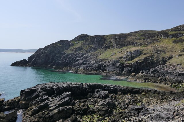
Bun Abhainn na Cloich, Isle of Lewis
Bun Abhainn na Cloich means Mouth of Stone River.
 Map © Crown Copyright")
TIP: Click the map for more Large scale mapping
- Grid Square
- NB5350, 42 images (more nearby 🔍)
- Photographer
- Claire Pegrum (more nearby)
- Date Taken
- Monday, 28 May, 2018 (more nearby)
- Submitted
- Thursday, 18 February, 2021
- Subject Location
-
OSGB36:
 NB 53920 50710 [1m precision]
WGS84: 58:22.5273N 6:12.6332W - Camera Location
-
OSGB36: NB 53922 50819
- View Direction
- SOUTH (about 180 degrees)