2021
SU5643 : Old Boundary Marker inside the northern boundary of College Wood
taken 3 years ago, near to Popham, Hampshire, England
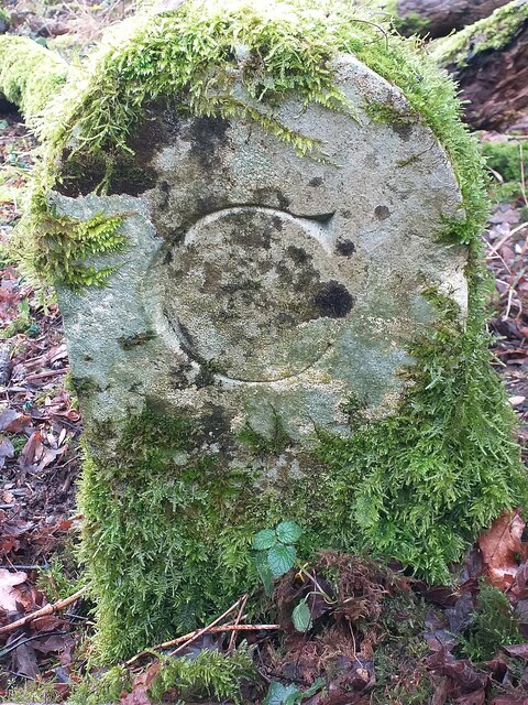
Old Boundary Marker inside the northern boundary of College Wood
Estate Boundary Marker just inside the northern boundary of College Wood on Right of Way 701. On the former boundary of Woodmancott and Popham parishes, and Micheldever and Popham parishes since 1985. Inscribed M and C on opposite faces. The inscriptions do not relate to the parish names and are thought to denote the landowners.
Milestone Society National ID: HA_MICPOP02em
Milestone Society National ID: HA_MICPOP02em
National Survey of Wayside Features by The Milestone Society
These images are from Link
 Map © Crown Copyright")
TIP: Click the map for more Large scale mapping
- Grid Square
- SU5643, 44 images (more nearby 🔍)
- Photographer
- S Bell (more nearby)
- Contributed by
- Mike Rayner (more nearby)
- Date Taken
- Wednesday, 17 February, 2021 (more nearby)
- Submitted
- Monday, 22 February, 2021
- Subject Location
-
OSGB36:
 SU 56168 43092 [1m precision]
WGS84: 51:11.0584N 1:11.8650W - Camera Location
-
OSGB36: SU 56168 43092