2021
NJ3259 : Former School
taken 3 years ago, near to Mosstodloch, Moray, Scotland
This is 1 of 2 images, with title Former School in this square
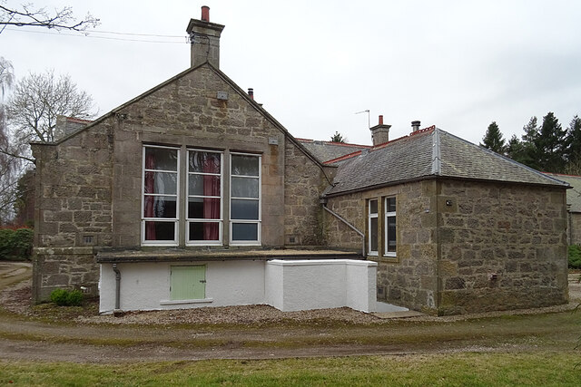
Former School
One look told me that this must have been a school, and a look at the first edition of the six-inch Ordnance Survey map, surveyed in 1870, confirmed that it was. Viewed from the forest path along the north side of its grounds.
 Map © Crown Copyright")
TIP: Click the map for more Large scale mapping
- Grid Square
- NJ3259, 39 images (more nearby 🔍)
- Photographer
- Anne Burgess (more nearby)
- Date Taken
- Wednesday, 3 March, 2021 (more nearby)
- Submitted
- Thursday, 4 March, 2021
- Subject Location
-
OSGB36:
 NJ 3270 5972 [10m precision]
WGS84: 57:37.3442N 3:7.7035W - Camera Location
-
OSGB36: NJ 3270 5973
- View Direction
- South-southwest (about 202 degrees)