2021
TA1028 : Humber: Hull Frontage Flood Defence Improvements
taken 3 years ago, near to Kingston Upon Hull, England
This is 1 of 16 images, with title Humber: Hull Frontage Flood Defence Improvements in this square
Humber: Hull Frontage Flood Defence Improvements
Planning permission was granted in November 2019 to improve the flood defences on Nelson Street/Victoria Pier. The existing flood defences - in the form of steel sheet piles - had reached the end of their useful life. The improvement work involved the installation of new steel sheet piles along the estuary frontage. Further information from the Environment Agency: Link
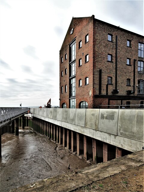
Depicted are works that have been undertaken adjacent to the footbridge that traverses the River Hull between Nelson Street and The Deep. At right, former warehouse, No.47 Queen Street.
Depicted are works that have been undertaken adjacent to the footbridge that traverses the River Hull between Nelson Street and The Deep. At right, former warehouse, No.47 Queen Street.
 Map © Crown Copyright")
TIP: Click the map for more Large scale mapping
- Grid Square
- TA1028, 3428 images (more nearby 🔍)
- Photographer
- Bernard Sharp (more nearby)
- Date Taken
- Tuesday, 9 March, 2021 (more nearby)
- Submitted
- Thursday, 11 March, 2021
- Subject Location
-
OSGB36:
 TA 1006 2821 [10m precision]
WGS84: 53:44.3200N 0:19.9713W - Camera Location
-
OSGB36: TA 1007 2823
- View Direction
- South-southwest (about 202 degrees)