2021

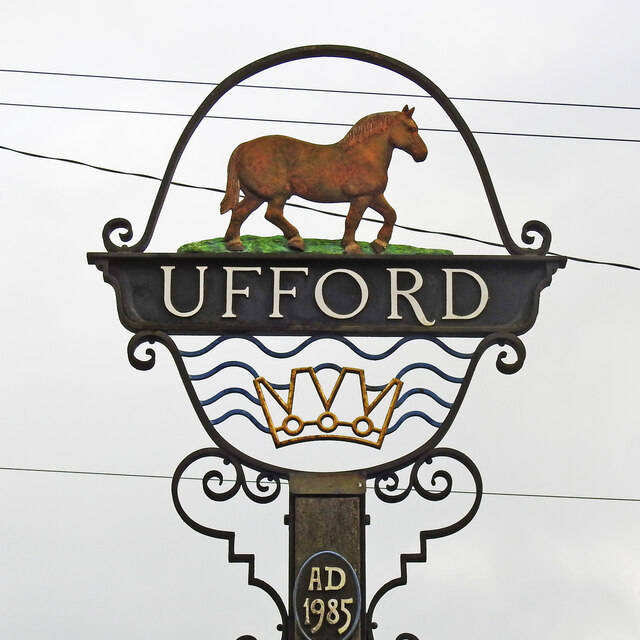
TM2952 : Ufford village sign (detail)

taken 6 years ago, near to Ufford, Suffolk, England
Ufford village sign (detail)
Ufford is famous for the Suffolk Punch and proudly displays one on the village sign. Every Punch horse can be traced back to 'Crisp's Stallion' of Ufford, foaled in 1768 and is one of the rarest of the heavy horses. Below the name is a crown and water representing the River Deben which flows around the eastern edge of the parish.

Creative Commons Licence [Some Rights Reserved]   © Copyright Adrian S Pye and licensed for reuse under this Creative Commons Licence.
Village Signs of East Anglia

Village signs are typically placed along the principal road or in a prominent location such as a village green or close by the church. The design often depicts a particularly feature of the village or a scene from its history, heritage, or culture. They are typically made of wood or metal or a combination of both, the designs are often made by the local community.
Although they do appear in villages and towns all over the country they are more prominent in East Anglia than elsewhere in the country.

Suffolk Village Signs (provided by N Chadwick)

Suffolk has the second largest number of village signs in the UK currently estimated at over 375. Very much an East Anglian tradition the idea originally came from just over the border, at Sandringham in Norfolk when the future Edward VII commissioned signs for the estate. Then in 1920 the then Duke of York gave a speech at the Royal Academy promoting the wider use of village signs following which the Daily Mail ran a national competition. Subsequently villages across the country took up the challenge but the concept was grasped most keenly in the east.

This photo is linked from: Articles: · Village signs of Suffolk ·
1:50,000 Modern Day Landranger(TM) Map © Crown Copyright
+
+
1:50,000 Modern Day Landranger(TM) Map © Crown Copyright
TIP: Click the map for more Large scale mapping
Grid Square
TM2952, 225 images   (more nearby 🔍)
Photographer
Adrian S Pye   (more nearby)
Date Taken
Monday, 15 February, 2021   (more nearby)
Submitted
Saturday, 13 March, 2021
Subject Location
OSGB36: geotagged! TM 2977 5234 [10m precision]
WGS84: 52:7.2954N 1:21.3005E
Camera Location
OSGB36: geotagged! TM 2978 5234
View Direction
WEST (about 270 degrees)
Clickable map
+
NW N NE
W Go E
SW S SE
Image Type (about): close look 
This page has been viewed about 134 times