2008
SX2574 : Old Boundary Marker at the western tip of Bearah Tor
taken 16 years ago, near to Henwood, Cornwall, England
Old Boundary Marker at the western tip of Bearah Tor
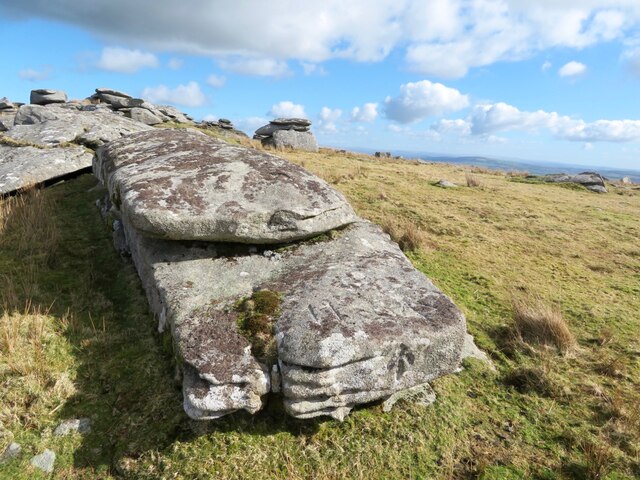
Estate Boundary Marker on a prominent flat rock at the extreme western tip of the summit ridge of Bearah Tor in Linkinhorne parish.
This boundary rock serves a threefold purpose; as an estate boundary marker, a parish boundary marker and as one of several similarly inscribed rocks that were carved in the 19th century to protect the natural features of the Tor. The uppermost flat surface of the rock bears the inscription 11 RIL 1846 and is one of the series of 10 stones and two rocks that marked the extent of the unenclosed moorland owned by Duchy of Cornwalls Rillaton Manor. At a lower level, slightly to the west of the above, a large arrow and the numeral 11 has been carved. The purpose of the arrow is unknown, but it may indicate the location of the parish boundary between Linkinhorne and North Hill. The number 11 was carved, on instructions of the Duchy of Cornwall in 1856, when a lease was granted for the cutting and quarrying of granite. These numbers were to be painted white and no stone was to be taken from above these marks. Numbers 1 to 21 were cut, but numbers 1,8, 10, 14, 15,16, 20 and 21 have not been located. Similarly, when a new lease of 1864 was signed, 31 fleur-de-lys were carved around the tor. These were generally at a higher altitude giving the quarrymen more scope for their work. Of these carvings, 29 have been located. One is located on the vertical, western face of this rock.
Milestone Society National ID: CW_LINRIL11em
National Survey of Wayside Features by The Milestone Society
These images are from Link
 Map © Crown Copyright")
TIP: Click the map for more Large scale mapping
- Grid Square
- SX2574, 19 images (more nearby 🔍)
- Photographer
- P G Moore (more nearby)
- Contributed by
- Mike Rayner (more nearby)
- Date Taken
- August 2008 (more nearby)
- Submitted
- Monday, 15 March, 2021
- Subject Location
-
OSGB36:
 SX 25664 74422 [1m precision]
WGS84: 50:32.6107N 4:27.7117W - Camera Location
-
OSGB36: SX 25664 74422