2020
SN1430 : Churn stand
taken 4 years ago, near to Mynachlog-Ddu, Pembrokeshire/Sir Benfro, Wales
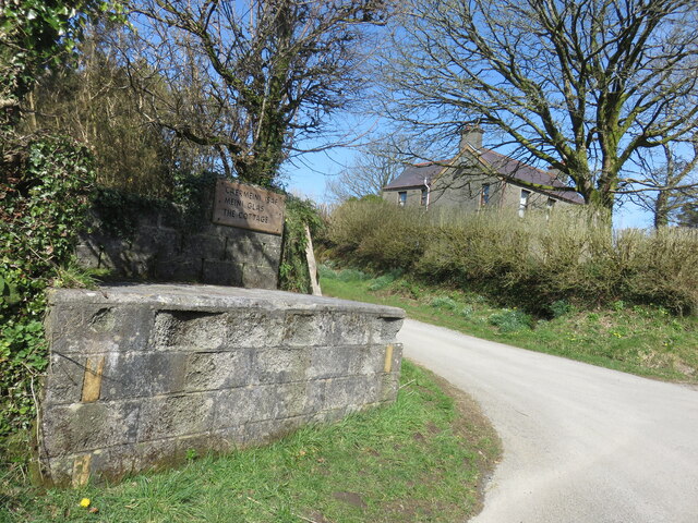
Churn stand
Another redundant roadside churn stand, perhaps once serving Carn Meini farm.
 Map © Crown Copyright")
TIP: Click the map for more Large scale mapping
- Grid Square
- SN1430, 12 images (more nearby 🔍)
- Photographer
- Natasha Ceridwen de Chroustchoff (more nearby)
- Date Taken
- Sunday, 22 March, 2020 (more nearby)
- Submitted
- Thursday, 18 March, 2021
- Subject Location
-
OSGB36:
 SN 1465 3081 [10m precision]
WGS84: 51:56.6897N 4:41.8896W - Camera Location
-
OSGB36: SN 1465 3081
- View Direction
- Northwest (about 315 degrees)