2016
SD2879 : The Cumbria Way, farm track near Heaning Wood
taken 8 years ago, near to Ulverston, Cumbria, England
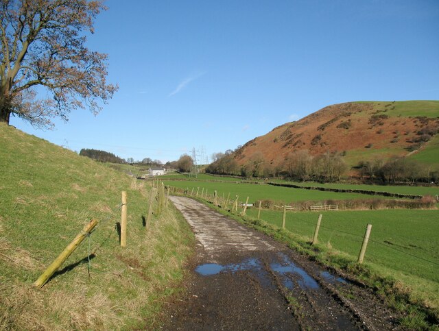
The Cumbria Way, farm track near Heaning Wood
The farm track is a public footpath and is the route of The Cumbria Way long distance footpath on the section between Stockbridge Lane and Old Hall Farm (next photograph SD2779 : The Cumbria Way near Old Hall Wood).
The Cumbria Way
A 119km (74 mile) long distance path from Ulverston to Carlisle, through the heart of the English Lake District.
 Map © Crown Copyright")
TIP: Click the map for more Large scale mapping
- Grid Square
- SD2879, 40 images (more nearby 🔍)
- Photographer
- Adrian Taylor (more nearby)
- Date Taken
- Wednesday, 10 February, 2016 (more nearby)
- Submitted
- Sunday, 21 March, 2021
- Subject Location
-
OSGB36:
 SD 28138 79509 [1m precision]
WGS84: 54:12.3759N 3:6.1945W - Camera Location
-
OSGB36: SD 28091 79137
- View Direction
- NORTH (about 0 degrees)