2021
SO4685 : Flounders' Folly
taken 3 years ago, near to Lower Dinchope, Shropshire, England
This is 1 of 6 images, with title Flounders' Folly in this square
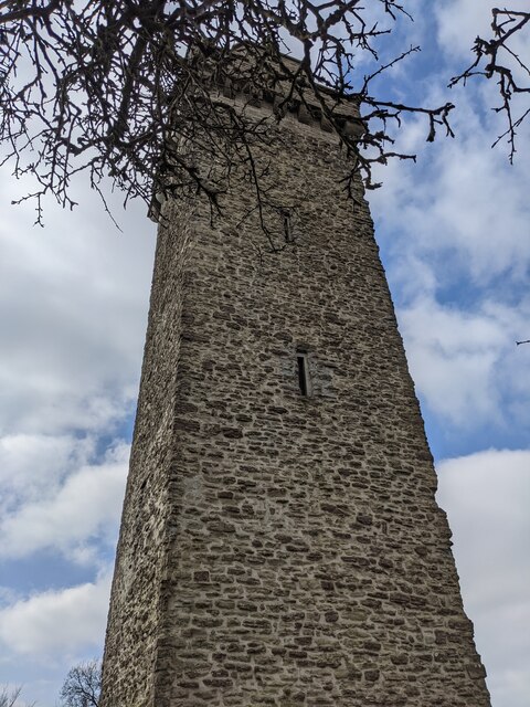
Flounders' Folly
On top of the 1,102ft (336m) tall Callow Hill is Flounders' Folly, a distinctive structure that can be seen from many miles around. It was constructed in 1838 by an English Quaker and Ludlow architect called by Benjamin Flounders. The structure remained derelict for many decades, and it was restored by the Flounders Folly Trust from 2004-05. The Princess Royal (Anne) reopened the folly on 31st October 2005, and is open on the last Sunday of each month (you can tell it's open when St. George's flag waves on top of the tower), except it is open on some special days like Good Friday. A friendly volunteer introduced us to the site!
 Map © Crown Copyright")
TIP: Click the map for more Large scale mapping
- Grid Square
- SO4685, 107 images (more nearby 🔍)
- Photographer
- Fabian Musto (more nearby)
- Date Taken
- Friday, 2 April, 2021 (more nearby)
- Submitted
- Saturday, 3 April, 2021
- Subject Location
-
OSGB36:
 SO 4606 8504 [10m precision]
WGS84: 52:27.6377N 2:47.7182W - Camera Location
-
OSGB36: SO 4606 8504
- View Direction
- South-southwest (about 202 degrees)