2008
SD8169 : Long Lane (Track)
taken 16 years ago, near to Helwith Bridge, North Yorkshire, England
This is 1 of 10 images, with title starting with Long Lane in this square
Long Lane (Track)
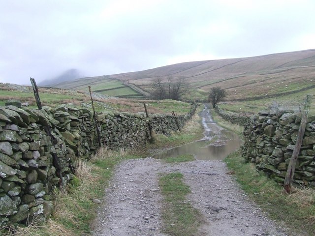
Long Lane, stretching away to the skyline, is frequently used by walkers to gain access to Pen y ghent (on the left shrouded in mist) from Helwith Bridge. The photo was taken at the junction of Long Lane and Moor Head Lane, the latter being the route of The Ribble Way between Helwith Bridge and Stainforth.
 Map © Crown Copyright")
TIP: Click the map for more Large scale mapping
- Grid Square
- SD8169, 190 images (more nearby 🔍)
- Photographer
- Roger Nunn (more nearby)
- Date Taken
- Tuesday, 5 February, 2008 (more nearby)
- Submitted
- Thursday, 7 February, 2008
- Subject Location
-
OSGB36:
 SD 818 697 [100m precision]
WGS84: 54:7.3755N 2:16.7885W - Camera Location
-
OSGB36: SD 817 695
- View Direction
- North-northeast (about 22 degrees)