2021
J3629 : Fire ravaged slopes above the Donard Ice House
taken 3 years ago, 3 km from Newcastle, Co Down, Northern Ireland
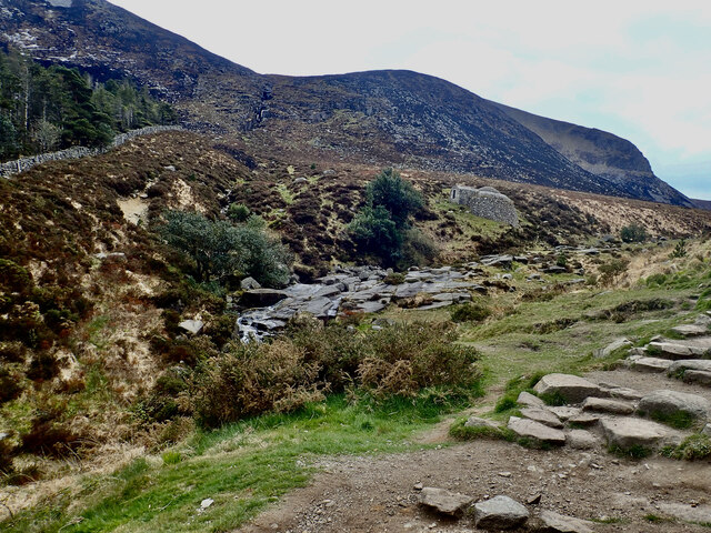
Fire ravaged slopes above the Donard Ice House
On Saturday and Sunday (24/25 April) the fire was brought under control along the line of the Glen River although there were minor incursions across the river leading to scorched trees on the north side of the path. The Donard Ice House escaped damage.
J3629 : Scorched trees on the north side of the Glen River
J3629 : Scorched trees on the north side of the Glen River
The April 2021 fire in the Mournes :: J3628
The wildfire of 22/26 of April in the High Mournes was probably the work of arsonists. The seat of the fire was in the Bloody Bridge area and despite the efforts of up to 100 firefighters spread to destroy the vegetation cover on Leganabruchan, Millstone Mountain, Thomas's Mountain, Crossone and Slieve Donard. The lack of water and inaccessibility of the area made the task more difficult. Irish Air Corps helicopters were unavailable this time due to commitments in the Republic's Killarney NP wildfire. The NIFRS personnel had to tackle the fire mainly by beating it out.
Loading map... (JavaScript required)
- Grid Square
- J3629, 301 images (more nearby 🔍)
- Photographer
- Eric Jones (more nearby)
- Date Taken
- Thursday, 29 April, 2021 (more nearby)
- Submitted
- Thursday, 29 April, 2021
- Subject Location
-
Irish:
 J 364 292 [100m precision]
WGS84: 54:11.6397N 5:54.6361W - Camera Location
-
Irish: J 364 295
- View Direction
- SOUTH (about 180 degrees)