2021
SJ4006 : Information board on local mines at the Nags Head, Pontesbury
taken 3 years ago, near to Pontesford, Shropshire, England
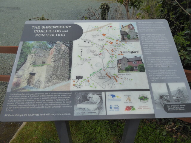
Information board on local mines at the Nags Head, Pontesbury
I had not noticed this info board until today, packed as it is with the history of local mine workings.
 Map © Crown Copyright")
TIP: Click the map for more Large scale mapping
- Grid Square
- SJ4006, 51 images (more nearby 🔍)
- Photographer
- Jeremy Bolwell (more nearby)
- Date Taken
- Wednesday, 28 April, 2021 (more nearby)
- Submitted
- Thursday, 29 April, 2021
- Subject Location
-
OSGB36:
 SJ 4063 0609 [10m precision]
WGS84: 52:38.9567N 2:52.7391W - Camera Location
-
OSGB36: SJ 4063 0609
- View Direction
- NORTH (about 0 degrees)