2021
SO3318 : Path to summit of Skirrid Fawr
taken 3 years ago, 3 km from Llanvihangel Crucorney, Monmouthshire/Sir Fynwy, Wales
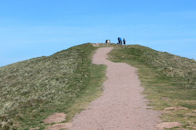
Path to summit of Skirrid Fawr
In earlier photographs the path is grassed, but is now stony and quite wide.
 Map © Crown Copyright")
TIP: Click the map for more Large scale mapping
- Grid Square
- SO3318, 75 images (more nearby 🔍)
- Photographer
- M J Roscoe (more nearby)
- Date Taken
- Friday, 23 April, 2021 (more nearby)
- Submitted
- Friday, 30 April, 2021
- Subject Location
-
OSGB36:
 SO 331 182 [100m precision]
WGS84: 51:51.5339N 2:58.3702W - Camera Location
-
OSGB36: SO 330 181
- View Direction
- NORTH (about 0 degrees)