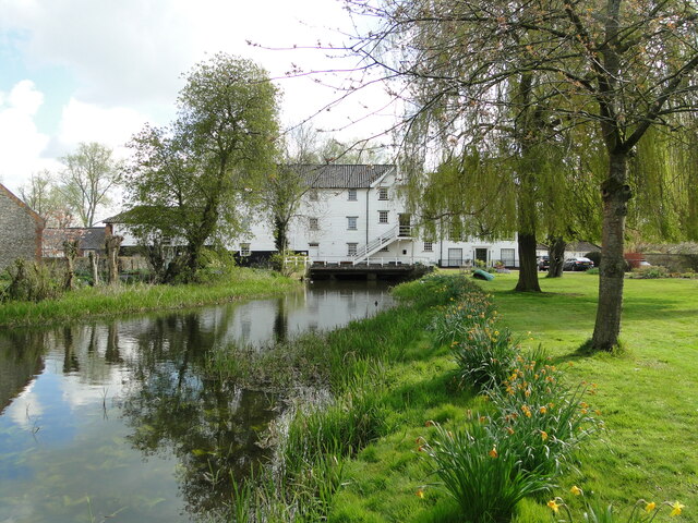
TM2783 : Mendham former watermill on the River Waveney
taken 5 years ago, near to Mendham, Suffolk, England
Access to the grounds was requested and granted by the kind permission of the owner.
The River Waveney forms the boundary between Suffolk and Norfolk. It rises at Redgrave Fen and flows in an easterly direction though the towns of Diss, Bungay (the head of navigation) and Beccles. There is a weir at Billingford, shortly after the River Dove, flowing northwards from Eye, joins the Waveney on the southern bank. The Waveney passes round Bungay and on to Beccles. Having skirted past Oulton Broad it passes through Somerleyton and Hadiscoe before merging with the Yare in Breydon Water.
Suffolk has twenty rivers worthy of the name. The River Waveney and the River Little Ouse form the boundary between Norfolk and Suffolk. The River Stour does the same for Suffolk and Essex. The Alde, the Blyth, the Deben and the Orwell are the main rivers and the others are tributaries or affluents of these. Among the names of these are the Gipping, the Box, the Lark, the Dove, the Snail and the Rat.
Other rivers and tributaries are the Minsmere, Fromus, Mill, Ore, Chad, Fynn, Kirton Creek, and Shottisham Creek, Belstead Brook, the Black Bourne, Eriswell Lode, Polstead Stream and Hol Brook. Edited by Adrian S. Pye
Suffolk has roughly 130 watermills listed as either lost, demolished, partial ruin or extant and converted to another use. Of these, either the mill or the miller's house, are now private houses, B&Bs or the larger ones, multiple occupancy flats. Watermills were by necessity beside a river or stream with enough flow to turn a waterwheel and the gears inside the mill. There are a number of options for the method in presenting the water to the paddles on the wheel. Undershot is where the bottom of the wheel sits in the flow. Breast shot is where the water is presented to the wheel halfway up and the wheel and doesn't sit in the stream. Overshot is where the water flows over the top of the wheel and is the most powerful of the three methods. A fourth method not used in Suffolk, is known as a pentrough or pitchback, which is similar to an overshot but turns the wheel in the opposite direction. See Link
. Mills were used to grinding corn, making paper, extracting oil, sawing wood and numerous other jobs which are listed in the above Wikipedia article. created by Adrian Pye


- Grid Square
- TM2783, 24 images (more nearby 🔍)
- Photographer
- Adrian S Pye (more nearby)
- Date Taken
- Sunday, 2 May, 2021 (more nearby)
- Submitted
- Sunday, 2 May, 2021
- Subject Location
-
OSGB36:
 TM 27100 83340
[1m precision]
WGS84: 52:24.0553N 1:20.2150E - Camera Location
-
OSGB36:
TM 2705 8330
- View Direction
- Northeast (about 45 degrees)


