NZ9309 : Gate on the path, near Hawsker
taken 3 years ago, near to Hawsker, North Yorkshire, England
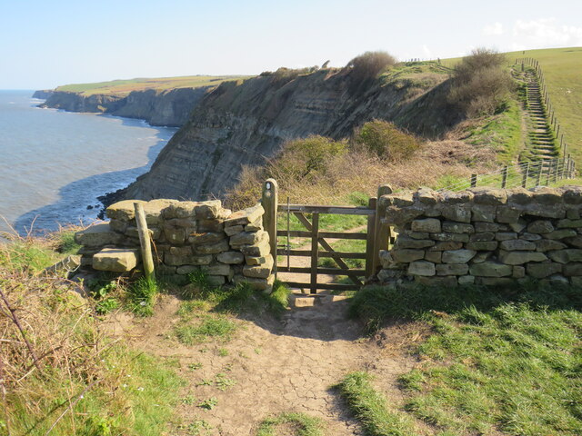
The King Charles III England Coast Path (ECP) will take advantage of new public rights of access to the coast, to form a 2,800 mile long public path right around England's coasts.
Parts of the path were already open in 2016, and it was intended at that time that the whole path would be completed by 2020. At that time, the path was called the England Coast Path. It was renamed King Charles III England Coast Path in 2023, in honour of the King's coronation.
More information about the ECP is on the National Trails website: Link
The Cleveland Way runs 110 miles (177 km) between Helmsley and the Brigg at Filey, skirting the North York Moors National Park. Its highest point is at Urra Moor, 1,489 ft (454 m).
For the Wikipedia article on the Cleveland Way see Link
 Map © Crown Copyright")
- Grid Square
- NZ9309, 50 images (more nearby 🔍)
- Photographer
- Malc McDonald (more nearby)
- Date Taken
- Wednesday, 28 April, 2021 (more nearby)
- Submitted
- Monday, 3 May, 2021
- Subject Location
-
OSGB36:
 NZ 9323 0949 [10m precision]
WGS84: 54:28.3333N 0:33.7734W - Camera Location
-
OSGB36: NZ 9323 0950
- View Direction
- SOUTH (about 180 degrees)