2021
NH6649 : Coastal tidal path between Croft Downie and Kilmuir
taken 3 years ago, near to Kilmuir, Highland, Scotland
This is 1 of 2 images, with title Coastal tidal path between Croft Downie and Kilmuir in this square
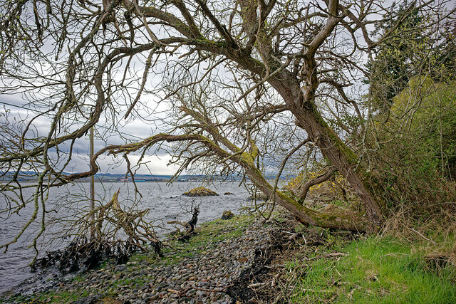
Coastal tidal path between Croft Downie and Kilmuir
Our visit coincided within minutes of the time of high tide. From the point below NH6649 : Rock bluff by the shoreline beside the Kilmuir path there is just a very limited section that may be walked before the coastal path is below the water. The signposted path to Kilmuir does not mention that the path is tidal, although that is local knowledge. It is quite a climb back up the hill to regain any other route to Kilmuir
 Map © Crown Copyright")
TIP: Click the map for more Large scale mapping
- Grid Square
- NH6649, 82 images (more nearby 🔍)
- Photographer
- Julian Paren (more nearby)
- Date Taken
- Saturday, 1 May, 2021 (more nearby)
- Submitted
- Thursday, 6 May, 2021
- Subject Location
-
OSGB36:
 NH 6696 4924 [10m precision]
WGS84: 57:30.8238N 4:13.3530W - Camera Location
-
OSGB36: NH 66967 49261
- View Direction
- South-southwest (about 202 degrees)