2021
TF1720 : Gate on former road approach to Counter Drain station
taken 3 years ago, near to Guthram Gowt, Lincolnshire, England
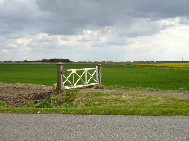
Gate on former road approach to Counter Drain station
The raw earth on the left is the result of levelling the site of a very recently demolished house - if I'd realized that I would have taken a better view of the site which included some rubble. The house was a railway house built in the 1930s, after the line closed it became 'The Earl's Cottage' (see TF1720 : Near site of Counter Drain station 2010), presumably bought for The Earl's Farm. The concrete gate posts are of an interesting design, no doubt made by the Midland and Great Northern Railway, who were very keen on concrete infrastructure items. Are there any views of similar posts elsewhere?
 Map © Crown Copyright")
TIP: Click the map for more Large scale mapping
- Grid Square
- TF1720, 54 images (more nearby 🔍)
- Photographer
- Robin Webster (more nearby)
- Date Taken
- Sunday, 2 May, 2021 (more nearby)
- Submitted
- Thursday, 6 May, 2021
- Subject Location
-
OSGB36:
 TF 17793 20844 [1m precision]
WGS84: 52:46.3409N 0:15.3226W - Camera Location
-
OSGB36: TF 17779 20858
- View Direction
- Southeast (about 135 degrees)