2021
SN4305 : Pont Spwdwr
taken 3 years ago, near to Trimsaran, Carmarthenshire/Sir Gaerfyrddin, Wales
This is 1 of 3 images, with title Pont Spwdwr in this square
Pont Spwdwr
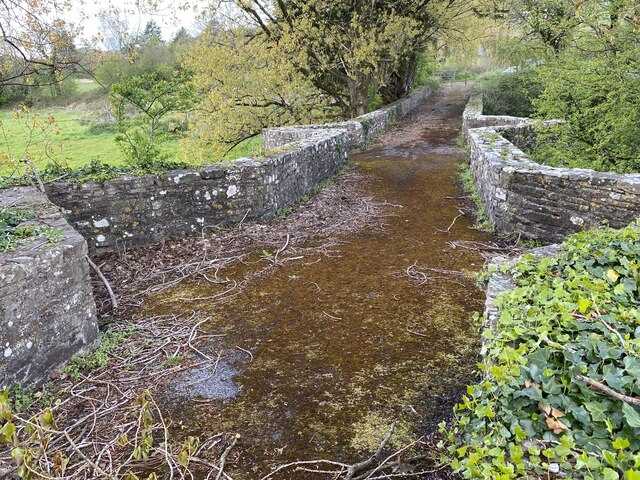
Pont Spwdwr, Spudder's Bridge, was probably built in the second half of the sixteenth century. The wing walls were added by Thomas Kymer in 1770. It is a single-carriageway rubble-stone bridge of four main spans, steeply ramped to the centre. The piers and abutments have V-shaped cutwaters rising to the parapet to form refuges. Each span has a pointed arch, of which the two central spans are wider and higher. The two southernmost arches span the river, the remaining two are built over floodplain. Further north ( - shown here) are two additional low and narrow pointed arches built over the floodplain on the approach to the bridge. The plain parapet continues on the north side, where it forms a field boundary and terminates in a field gate. [Coflein].
 Map © Crown Copyright")
TIP: Click the map for more Large scale mapping
- Grid Square
- SN4305, 18 images (more nearby 🔍)
- Photographer
- Alan Hughes (more nearby)
- Date Taken
- Wednesday, 5 May, 2021 (more nearby)
- Submitted
- Friday, 7 May, 2021
- Subject Location
-
OSGB36:
 SN 43374 05909 [1m precision]
WGS84: 51:43.7973N 4:16.1609W - Camera Location
-
OSGB36: SN 43384 05899
- View Direction
- Northwest (about 315 degrees)