2021
TQ5452 : Bluebells at Riverhill Himalayan Gardens
taken 3 years ago, near to Underriver, Kent, England
This is 1 of 6 images, with title Bluebells at Riverhill Himalayan Gardens in this square
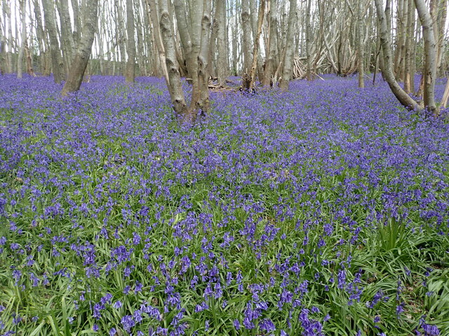
Bluebells at Riverhill Himalayan Gardens
Originally built on the site of a Tudor farmstead in 1714 Riverhill House is Grade II listed. It is located on the south-facing slope of the Greensand Ridge. In 1840 John Rogers bought Riverhill. He was an only child, with a modest fortune, and a fine intellect. He became a classics scholar, a scientist and a friend of Charles Darwin. He was one of the first members of the Royal Horticultural Society and a patron of the plant collectors of the day.
He chose Riverhill because its sheltered situation offered an ideal lime free hillside where he could hope to establish newly introduced trees and shrubs. Planting started in 1842. Subsequent generations, continued the planting and in 1910 Colonel John Middleton Rogers created what is now known as The Wood Garden a collection of Japanese Maples, Rhododendrons and Azaleas.
Until the beginning of the 2nd World War, eight full time gardeners kept Riverhill looking immaculate. Since the War, however, a shortage of personnel and a lack of money has meant that the garden was allowed to deteriorate, with many parts of the original planting lost to everyday use and visitors.
Today, four generations of the Rogers family live at Riverhill and the estate is managed by Edward Rogers (great-great-great-grandson of the John Rogers who bought Riverhill in 1840) and his wife, Sarah.
It is now frequently open to the public with a tea room and children's activities. One of the most recent additions is a maze. This is part of the Bluebell Trail in the Chestnut Wood.
See Link for more information.
He chose Riverhill because its sheltered situation offered an ideal lime free hillside where he could hope to establish newly introduced trees and shrubs. Planting started in 1842. Subsequent generations, continued the planting and in 1910 Colonel John Middleton Rogers created what is now known as The Wood Garden a collection of Japanese Maples, Rhododendrons and Azaleas.
Until the beginning of the 2nd World War, eight full time gardeners kept Riverhill looking immaculate. Since the War, however, a shortage of personnel and a lack of money has meant that the garden was allowed to deteriorate, with many parts of the original planting lost to everyday use and visitors.
Today, four generations of the Rogers family live at Riverhill and the estate is managed by Edward Rogers (great-great-great-grandson of the John Rogers who bought Riverhill in 1840) and his wife, Sarah.
It is now frequently open to the public with a tea room and children's activities. One of the most recent additions is a maze. This is part of the Bluebell Trail in the Chestnut Wood.
See Link
 Map © Crown Copyright")
TIP: Click the map for more Large scale mapping
- Grid Square
- TQ5452, 233 images (more nearby 🔍)
- Photographer
- Marathon (more nearby)
- Date Taken
- Friday, 7 May, 2021 (more nearby)
- Submitted
- Friday, 7 May, 2021
- Subject Location
-
OSGB36:
 TQ 5430 5227 [10m precision]
WGS84: 51:14.9240N 0:12.5682E - Camera Location
-
OSGB36: TQ 5428 5224
- View Direction
- North-northeast (about 22 degrees)