2010
SO8687 : Lock overflow weir near Ashwood in Staffordshire
taken 14 years ago, near to Kingswinford, Dudley, England
Lock overflow weir near Ashwood in Staffordshire
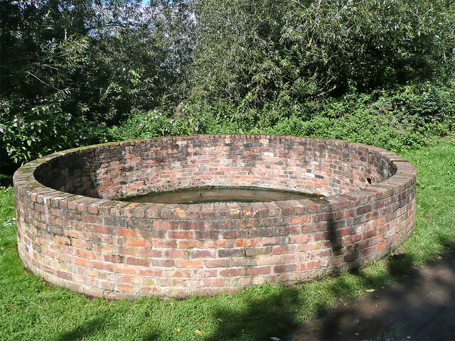
This is the by Staffordshire and Worcestershire Canal at Rocky Lock.
The circular brick wall surrounds an overflow weir letting surplus water bypass the lock.
The circular brick wall surrounds an overflow weir letting surplus water bypass the lock.
 Map © Crown Copyright")
TIP: Click the map for more Large scale mapping
- Grid Square
- SO8687, 237 images (more nearby 🔍)
- Photographer
- Roger D Kidd (more nearby)
- Date Taken
- Sunday, 29 August, 2010 (more nearby)
- Submitted
- Monday, 10 May, 2021
- Subject Location
-
OSGB36:
 SO 8640 8750 [10m precision]
WGS84: 52:29.1148N 2:12.1020W - Camera Location
-
OSGB36: SO 8639 8749
- View Direction
- Northeast (about 45 degrees)