2021
TA2119 : Humber Marshland
taken 3 years ago, 5 km W of Sunk Island, East Riding of Yorkshire, England
This is 1 of 3 images, with title Humber Marshland in this square
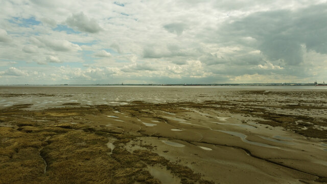
Humber Marshland
The consistency of this marshy area contains less vegetation than the ones to the north west of here. The Lincolnshire coastline can be seen in the distance. The photo was taken by drone as it's impossible to reach on foot as there's a 5m wide 'sloppy mud' creek to the north east of here! A drone fitted with GPS brought the camera to the correct position.
 Map © Crown Copyright")
TIP: Click the map for more Large scale mapping
- Grid Square
- TA2119, 4 images (more nearby 🔍)
- Photographer
- Andy Beecroft (more nearby)
- Date Taken
- Wednesday, 12 May, 2021 (more nearby)
- Submitted
- Wednesday, 12 May, 2021
- Subject Location
-
OSGB36:
 TA 2189 1906 [10m precision]
WGS84: 53:39.2305N 0:9.4315W - Camera Location
-
OSGB36: TA 2195 1995
- View Direction
- SOUTH (about 180 degrees)