2008
TQ8565 : Newington CE (Controlled) Primary School
taken 16 years ago, near to Newington, Kent, England
This is 1 of 2 images, with title Newington CE (Controlled) Primary School in this square
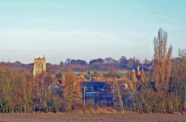
Newington CE (Controlled) Primary School
Pictured here in its full setting. The church and oast houses are in square TQ8665. See also TQ8565 : Newington CE (Controlled) Primary School
 Map © Crown Copyright")
TIP: Click the map for more Large scale mapping
- Grid Square
- TQ8565, 64 images (more nearby 🔍)
- Photographer
- Richard Dorrell (more nearby)
- Date Taken
- Sunday, 10 February, 2008 (more nearby)
- Submitted
- Sunday, 10 February, 2008
- Subject Location
-
OSGB36:
 TQ 859 653 [100m precision]
WGS84: 51:21.3804N 0:40.1471E - Camera Location
-
OSGB36: TQ 856 653
- View Direction
- EAST (about 90 degrees)