NU1242 : End of the Pilgrims' Path
taken 3 years ago, near to Holy Island, Northumberland, England
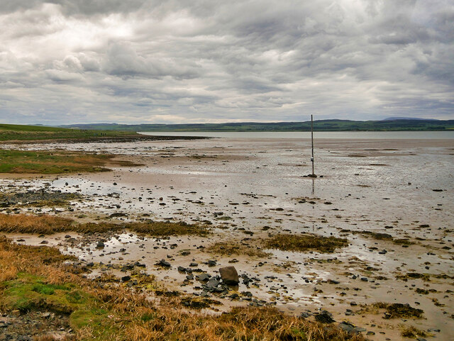
The Holy Island of Lindisfarne, commonly known as either Holy Island or Lindisfarne, is a tidal island which lies off the northeast coast of England, to the north of Bamburgh and the tidal estuary-like mud flats of Budle Bay. It is only accessible from the mainland at low tide by means of a modern causeway, which can be reached from the village of Beal, and an ancient pilgrims' path that runs over sand and mudflats and which are covered with water at high tide.
The island itself is about 3 miles wide from west to east and about one and a half miles from north to south. At the 2011 census, the island had a population of 180. Which is boosted by the well over 650,000 visitors coming from all over the world every year. Locally the island is rarely referred to by its Anglo-Saxon name of 'Lindisfarne'. Following on from the savage attacks on the monastery by the Vikings in 793AD, it obtained its local name Holy Island from the observations made by the Durham monks: 'Lindisfarne - truly a 'Holy Island' baptised in the blood of so many good men.... But its more appropriate title is, 'The Holy Island of Lindisfarne'.
 Map © Crown Copyright")
- Grid Square
- NU1242, 261 images (more nearby 🔍)
- Photographer
- David Dixon (more nearby)
- Date Taken
- Saturday, 22 May, 2021 (more nearby)
- Submitted
- Friday, 28 May, 2021
- Subject Location
-
OSGB36:
 NU 122 425 [100m precision]
WGS84: 55:40.5829N 1:48.3876W - Camera Location
-
OSGB36: NU 123 426
- View Direction
- South-southwest (about 202 degrees)