2021
SX4852 : Mount Batten Beach and Cattewater
taken 3 years ago, near to Turnchapel, Plymouth, England
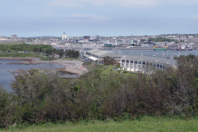
Mount Batten Beach and Cattewater
The grassland above Batten Bay offers a panoramic vista across Plymouth Sound, the City of Plymouth and Cattewater. In this view Mount Batten beach and headland are in the middle distance. Mount Batten was named after a Captain Batten who defended the headland in the Civil War - it has nothing to do with Lord Louis Mountbatten, Prince of Battenberg, although that subtlety seems to have been lost on whoever named the terrace of modern town houses behind the beach 'Lord Louis Crescent'.
 Map © Crown Copyright")
TIP: Click the map for more Large scale mapping
- Grid Square
- SX4852, 35 images (more nearby 🔍)
- Photographer
- Stephen McKay (more nearby)
- Date Taken
- Sunday, 30 May, 2021 (more nearby)
- Submitted
- Thursday, 3 June, 2021
- Subject Location
-
OSGB36:
 SX 4890 5292 [10m precision]
WGS84: 50:21.4048N 4:7.5300W - Camera Location
-
OSGB36: SX 4895 5271
- View Direction
- North-northwest (about 337 degrees)