2021
ND3984 : Swona
taken 3 years ago, 5 km W of Burwick, Mainland, Orkney Islands, Scotland
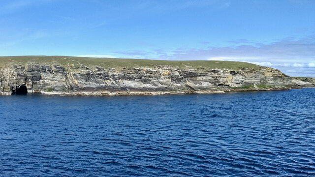
Swona
The island is situated in the Pentland Firth where it creates an obstruction to the strong tides producing tidal races, over-falls and whirlpools. One of these whirlpools is known as the Wells of Swona, and legend has it is caused by a witch struggling to save herself. To quote directly from Westwood and Kingshills book The Lore of Scotland: A guide to Scottish legends:
"A witch once took a fancy to a dark and handsome young man and wanted him for her lover. When she asked him to go to the beach with her, however, he refused, as his sweetheart was at that moment on her way to join him. Concealing her anger, the witch persuaded the young man and his girl to come out with her in her boat. As they approached Swona, she worked a spell on the boat and it overturned. The young man caught his girls hand in an attempt to save her, but at the same moment the witch caught hold of his to drag him under the waves and into her power. The three were so entangled that they could not be pulled apart. The young man and his sweetheart were drowned, but the witch is still struggling to get free, and it is her frantic churning of the waters that causes the Wells of Swona."
Adapted from my daily photo diary Link
See other images of The Witch of Swona
 Map © Crown Copyright")
TIP: Click the map for more Large scale mapping
- Grid Square
- ND3984, 19 images (more nearby 🔍)
- Photographer
- Mick Garratt (more nearby)
- Date Taken
- Sunday, 16 May, 2021 (more nearby)
- Submitted
- Sunday, 6 June, 2021
- Subject Location
-
OSGB36:
 ND 3923 8447 [10m precision]
WGS84: 58:44.6157N 3:3.1002W - Camera Location
-
OSGB36: ND 39390 84373
- View Direction
- West-northwest (about 292 degrees)