2021
SE1215 : Huddersfield Narrow Canal, Huddersfield
taken 3 years ago, near to Huddersfield, Kirklees, England
This is 1 of 4 images, with title Huddersfield Narrow Canal, Huddersfield in this square
Huddersfield Narrow Canal, Huddersfield
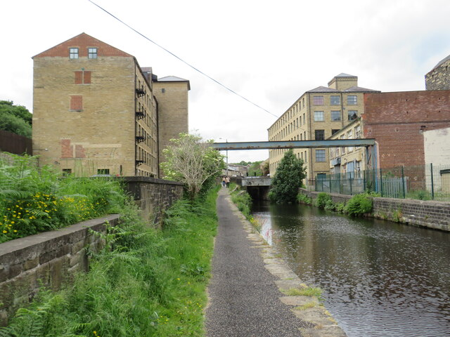
The Huddersfield Narrow Canal passing mill buildings as it heads out of Huddersfield.
Huddersfield Narrow Canal
The Huddersfield Narrow Canal opened in 1811. It runs for just under 20 miles from Lock 1E, where it joins the Huddersfield Broad Canal at the rear of the University of Huddersfield campus, to the junction with the Ashton Canal at Whitelands Basin in Ashton-under-Lyne. It crosses the Pennines by means of 74 locks and the Standedge Tunnel.
 Map © Crown Copyright")
TIP: Click the map for more Large scale mapping
- Grid Square
- SE1215, 221 images (more nearby 🔍)
- Photographer
- Malc McDonald (more nearby)
- Date Taken
- Sunday, 13 June, 2021 (more nearby)
- Submitted
- Sunday, 20 June, 2021
- Subject Location
-
OSGB36:
 SE 1210 1583 [10m precision]
WGS84: 53:38.3310N 1:49.1080W - Camera Location
-
OSGB36: SE 1212 1584
- View Direction
- West-southwest (about 247 degrees)