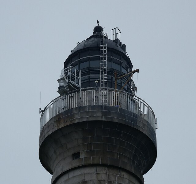
NL8426 : Skerryvore Lighthouse - the lantern
taken 3 years ago, 18 km SW of Balephuil, Tiree, Argyll And Bute, Scotland
Skerryvore is an islet with a host of associated skerries and rocks which poses a major hazard to shipping off the southwest coast of Tiree. Between 1790 and 1844 more than 30 ships were lost with all crew on these rocks.
It was therefore decided that a lighthouse should be built to aid shipping to avoid these formidable obstacles.
Between 1838 and 1844 the Skerryvore lighthouse was built, designed and overseen by Alan Stevenson, scion of the Stevenson family who are responsible for the majority of Scottish lighthouses.
At a height of 156' (48m) it is the tallest lighthouse in Scotland (just 5' (<2m) shorter than Britain's tallest lighthouse, Bishop Rock). It has a focal height of 151' (46m) and a nominal range of 23 nautical miles.
Until 1994 it was still manned on a permanent basis by lighthouse keepers at which time it was automated. However between 1954 and 1959 it was out of action due to a disastrous fire on the night of 16th March 1954 which had destroyed its lantern and upper stages. During this period various temporary lights were installed to warn shipping of the dangers.
Skerryvore islet statistics:
Area: (measured using magic.defra maps - Main Rock Only) 6,564m² (1.6 acres)
(For some reason Wikipedia quotes 26m² (280ft²) which is tiny - and wrong)
The main rock is joined to its neighbour by a bridge. This second rock which used to house the barracks, has an area of about 2482m² (0.6 acre)
Maximum height: 3m (10') at high tide.
Population: 0
 Map © Crown Copyright")
- Grid Square
- NL8426, 6 images (more nearby 🔍)
- Photographer
- Rob Farrow (more nearby)
- Date Taken
- Friday, 2 July, 2021 (more nearby)
- Submitted
- Monday, 5 July, 2021
- Subject Location
-
OSGB36:
 NL 8400 2628 [10m precision]
WGS84: 56:19.3885N 7:6.8094W - Camera Location
-
OSGB36: NL 8403 2622
- View Direction
- North-northwest (about 337 degrees)