SE0986 : The Forbidden Corner. Manneken-Pis
taken 3 years ago, near to Agglethorpe, North Yorkshire, England
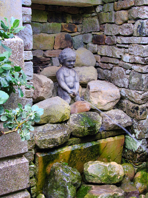
The Forbidden Corner is a folly garden located in the Tupgill Park Estate at Coverdale in the Yorkshire Dales National Park. Set in woodland, it was originally built as a private pleasure garden in the 1980s by Colin Armstrong, the owner of Tupgill Park. The garden was opened to the public in 1997 but The National Park's planners raised concerns about the environmental impact and pollution of the large number of cars entering the Park to visit the garden, and that the garden did not agree with the aims of a national park. An enforcement order to remove the structures and close the site to the public was overturned in 2000, on condition of restricting the number of visitors entering the site to 120 per hour which means that entry is by tickets pre-purchased online or pre-booked from an office in Middleham.
Based in the walled gardens of the 600 hectares estate, the Forbidden Corner is set out as a maze. It features statues, sculptures, towers, tunnels, a labyrinth (with revolving floor), water fountains and well as grottoes. It also has a cafe and gift shop.
 Map © Crown Copyright")
- Grid Square
- SE0986, 102 images (more nearby 🔍)
- Photographer
- David Dixon (more nearby)
- Date Taken
- Saturday, 3 July, 2021 (more nearby)
- Submitted
- Monday, 12 July, 2021
- Subject Location
-
OSGB36:
 SE 093 866 [100m precision]
WGS84: 54:16.5248N 1:51.4842W - Camera Location
-
OSGB36: SE 093 866
- View Direction
- East-northeast (about 67 degrees)