1989
NY7845 : Farmhouse at Roughside in September 1989
taken 35 years ago, near to Nenthead, Cumbria, England
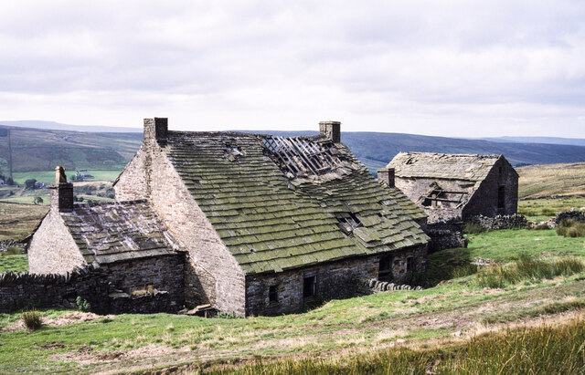
Farmhouse at Roughside in September 1989
The site of Roughside is north of Nenthead on the moorland slope of The Dodd at an altitude of over 520 m. The farmhouse at the centre of the image was lost many years ago but the remains of barns still survive.
 Map © Crown Copyright")
TIP: Click the map for more Large scale mapping
- Grid Square
- NY7845, 30 images (more nearby 🔍)
- Photographer
- Trevor Littlewood (more nearby)
- Date Taken
- Sunday, 10 September, 1989 (more nearby)
- Submitted
- Friday, 23 July, 2021
- Subject Location
-
OSGB36:
 NY 784 452 [100m precision]
WGS84: 54:48.0940N 2:20.2421W - Camera Location
-
OSGB36: NY 784 452
- View Direction
- West-southwest (about 247 degrees)