2021
SD9070 : Moorland road heading south at Darnbrook Farm
taken 3 years ago, 3 km from Arncliffe, North Yorkshire, England
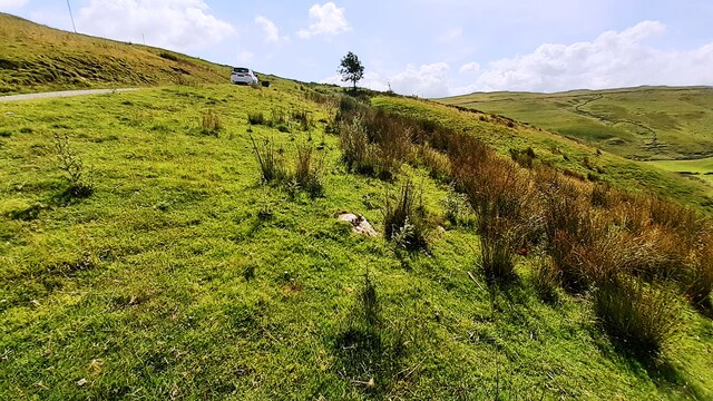
Moorland road heading south at Darnbrook Farm
There is an Ordnance Survey benchmark SD9070 : Benchmark on rock off SW side of moorland road south of Darnbrook House on the rock in the middle of the image
 Map © Crown Copyright")
TIP: Click the map for more Large scale mapping
- Grid Square
- SD9070, 18 images (more nearby 🔍)
- Photographer
- Roger Templeman (more nearby)
- Date Taken
- Tuesday, 3 August, 2021 (more nearby)
- Submitted
- Thursday, 5 August, 2021
- Subject Location
-
OSGB36:
 SD 9003 7043 [10m precision]
WGS84: 54:7.7774N 2:9.2438W - Camera Location
-
OSGB36: SD 9001 7047
- View Direction
- South-southeast (about 157 degrees)