2021
SK8320 : St Mary's Church
taken 3 years ago, near to Garthorpe, Leicestershire, England
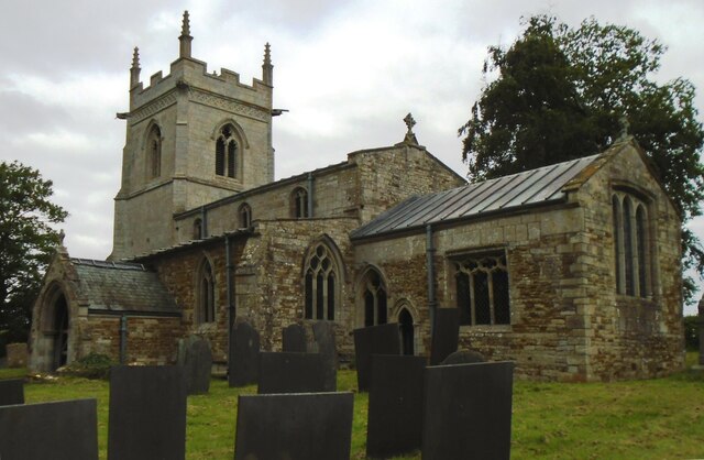
St Mary's Church
There is an Ordnance Survey benchmark SK8320 : Benchmark on St Mary's Church on the near corner, right hand face, of the church, and above it is an earlier benchmark SK8320 : Repositioned and inverted benchmark on St Mary's Church which has been repositioned and inverted
 Map © Crown Copyright")
TIP: Click the map for more Large scale mapping
- Grid Square
- SK8320, 99 images (more nearby 🔍)
- Photographer
- Phil Richards (more nearby)
- Date Taken
- Thursday, 15 July, 2021 (more nearby)
- Submitted
- Friday, 6 August, 2021
- Subject Location
-
OSGB36:
 SK 8316 2093 [10m precision]
WGS84: 52:46.7735N 0:46.1141W - Camera Location
-
OSGB36: SK 8319 2093
- View Direction
- WEST (about 270 degrees)