2021
SU3008 : Pubs in Lyndhurst
taken 3 years ago, near to Lyndhurst, Hampshire, England
Pubs in Lyndhurst
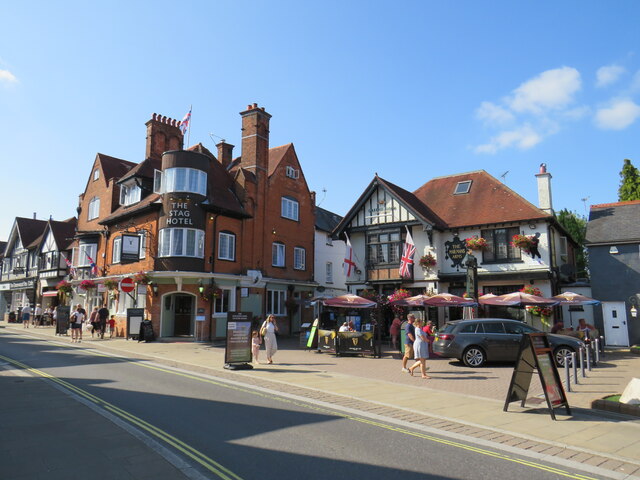
The Stag Hotel and The Mailman's Arms in the village of Lyndhurst. The Mailman's Arms is one of the Greene King chain of pubs.
The road in the foreground forms part of the A35 heading eastwards through the village. The road is a one-way street, part of a one-way system which takes traffic through the village.
The road in the foreground forms part of the A35 heading eastwards through the village. The road is a one-way street, part of a one-way system which takes traffic through the village.
Greene King
Greene King is a British brewery established in 1799 in Bury St Edmunds, Suffolk, and operates over 1600 pubs around the United Kingdom.
Greene King also own numerous other pub brands including Chef & Brewer, Hungry Horse and Flaming Grill.
Wikipedia; Link Official site Link
The A35
The A35 is a major (and regularly congested) route along England's south coast. It runs for 97 miles, connecting Honiton in Devon with Southampton in Hampshire, via Poole and Bournemouth, with much of its route passing through Dorset and the New Forest. It is a trunk road for some of its length.
Link
 Map © Crown Copyright")
TIP: Click the map for more Large scale mapping
- Grid Square
- SU3008, 243 images (more nearby 🔍)
- Photographer
- Malc McDonald (more nearby)
- Date Taken
- Thursday, 26 August, 2021 (more nearby)
- Submitted
- Saturday, 28 August, 2021
- Subject Location
-
OSGB36:
 SU 3006 0821 [10m precision]
WGS84: 50:52.3568N 1:34.4496W - Camera Location
-
OSGB36: SU 3007 0818
- View Direction
- North-northwest (about 337 degrees)