2021
SZ0789 : Promenade at Branksome Dene Chine, near Bournemouth
taken 3 years ago, near to Westbourne, Bournemouth, Christchurch & Poole, England
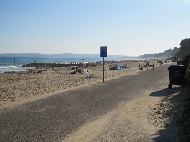
Promenade at Branksome Dene Chine, near Bournemouth
A promenade runs for around 10 miles along the seafront at Bournemouth, stretching to Southbourne in the east and Sandbanks in the west. The last few miles to Sandbanks are in the Borough of Poole, rather than in Bournemouth.
The promenade forms part of the route of National Cycle Network route 2, which stretches along England's south coast. However, during the peak summer holiday months of July and August, cycling is prohibited on the promenade between 10:00 and 18:00. Between those times, cyclists must use an alternative route.
This image was taken just beyond the Bournemouth/Poole boundary, looking westwards on a fine and sunny afternoon in August 2021.
National Cycle Network Route 2
National Route 2 will link Dover with St. Austell when complete via the south coast of England and is sometimes referred to as the South Coast Cycle Route.
The route is only fully open, at present, and signed between Dover and Brighton, but is still under development between Brighton and St. Austell.
The National Cycle Network
The National Cycle Network is a network of cycle routes. It was created by the charity Sustrans Link
(Sustainable Transport), aided by a National Lottery grant.
Many routes aim to minimise contact with motor traffic, though 70% of them are on roads. In some cases the NCN uses pedestrian routes, disused railways, minor roads, canal towpaths, or traffic-calmed routes in towns and cities.
 Map © Crown Copyright")
TIP: Click the map for more Large scale mapping
- Grid Square
- SZ0789, 30 images (more nearby 🔍)
- Photographer
- Malc McDonald (more nearby)
- Date Taken
- Wednesday, 25 August, 2021 (more nearby)
- Submitted
- Sunday, 29 August, 2021
- Subject Location
-
OSGB36:
 SZ 0706 8997 [10m precision]
WGS84: 50:42.5594N 1:54.0826W - Camera Location
-
OSGB36: SZ 0708 8999
- View Direction
- Southwest (about 225 degrees)