2021
NY5131 : Benchmark, White Ox Farm
taken 3 years ago, near to Penrith, Cumbria, England
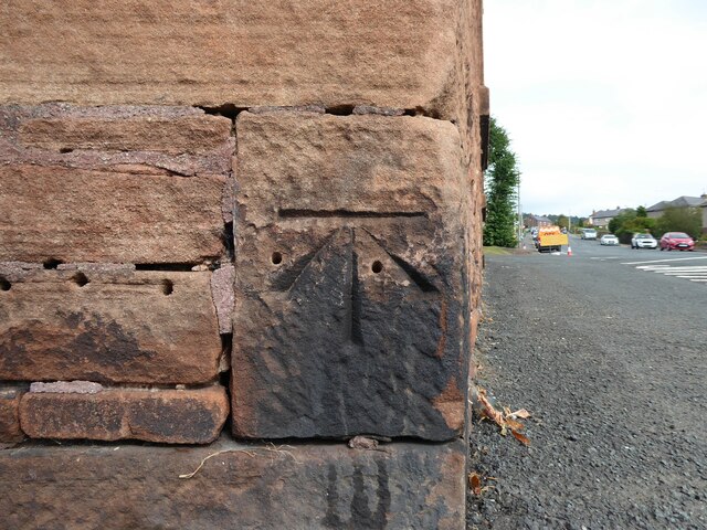
Benchmark, White Ox Farm
Detail of the Ordnance Survey cut benchmark on the south west corner of White Ox Farm house. The benchmark marks a height of 160.2547m above mean sea level (Ordnance Datum Newlyn) last verified in 1972 (location photograph NY5131 : White Ox Farm, Penrith).
 Map © Crown Copyright")
TIP: Click the map for more Large scale mapping
- Grid Square
- NY5131, 47 images (more nearby 🔍)
- Photographer
- Adrian Taylor (more nearby)
- Date Taken
- Monday, 6 September, 2021 (more nearby)
- Submitted
- Tuesday, 7 September, 2021
- Subject Location
-
OSGB36:
 NY 51075 31170 [1m precision]
WGS84: 54:40.3925N 2:45.6107W - Camera Location
-
OSGB36: NY 51075 31170
- View Direction
- East-northeast (about 67 degrees)