2021
NU2337 : The Farne Islands
taken 3 years ago, near to Brownsman [other Features], Northumberland, Great Britain
The Farne Islands
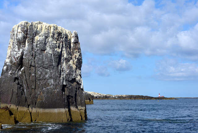
Longstones lighthouse can be beyond Brownsman. The Pinnacles of Staple Island are in the foreground.
Farne Islands
A group of 15 - 20 islands (depending on the tides) offshore of Seahouses, Northumberland. They are the most easterly outcrops of the Whin Sill (a dolerite intrusion across north east England). The islands are divided into the inner and outer islands. The Islands are an important breeding ground for many seabirds having a large Puffin population. There is also an important seal colony here. The whole area is designated a National Nature Reserve.
Wikipedia: Link
 Map © Crown Copyright")
TIP: Click the map for more Large scale mapping
- Grid Square
- NU2337, 324 images (more nearby 🔍)
- Photographer
- habiloid (more nearby)
- Date Taken
- Wednesday, 18 August, 2021 (more nearby)
- Submitted
- Saturday, 11 September, 2021
- Subject Location
-
OSGB36:
 NU 2391 3748 [10m precision]
WGS84: 55:37.8184N 1:37.3091W - Camera Location
-
OSGB36: NU 23873 37411
- View Direction
- North-northeast (about 22 degrees)