2012
SX4855 : Old Boundary marker on Ermington Terrace, Plymouth
taken 12 years ago, near to Plymouth, England
Old Boundary marker on Ermington Terrace, Plymouth
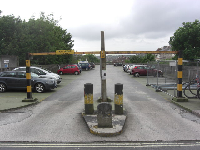
Municipal Boundary Marker in front of two bollards at the entrance to Ermington Terrace car park, Plymouth. Inscribed R.C. SERPELL / 1871 for Robert Coad Serpell, mayor.
Milestone Society National ID: DV_PCBS27pb
Milestone Society National ID: DV_PCBS27pb
National Survey of Wayside Features by The Milestone Society
These images are from Link
 Map © Crown Copyright")
TIP: Click the map for more Large scale mapping
- Grid Square
- SX4855, 584 images (more nearby 🔍)
- Photographer
- T Jenkinson (more nearby)
- Contributed by
- Mike Rayner (more nearby)
- Date Taken
- Monday, 28 May, 2012 (more nearby)
- Submitted
- Wednesday, 22 September, 2021
- Subject Location
-
OSGB36:
 SX 48352 55644 [1m precision]
WGS84: 50:22.8651N 4:8.0578W - Camera Location
-
OSGB36: SX 48352 55644
- View Direction
- WEST (about 270 degrees)