2021
NU1735 : Bamburgh Lighthouse
taken 3 years ago, near to Bamburgh, Northumberland, England
This is 1 of 11 images, with title Bamburgh Lighthouse in this square
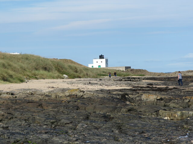
Bamburgh Lighthouse
Bamburgh Lighthouse (also known as Blackrocks Point Lighthouse) was built by Trinity House in 1910 to guide shipping both passing along the Northumberland coast and in the waters around the Farne Islands. It was extensively modernised in 1975 and is now monitored from the Trinity House Operations and Planning Centre in Harwich. Routine maintenance is carried out by a local attendant. It is the most northerly land-based lighthouse in England.
 Map © Crown Copyright")
TIP: Click the map for more Large scale mapping
- Grid Square
- NU1735, 249 images (more nearby 🔍)
- Photographer
- Geoff Holland (more nearby)
- Date Taken
- Wednesday, 22 September, 2021 (more nearby)
- Submitted
- Friday, 24 September, 2021
- Subject Location
-
OSGB36:
 NU 1749 3592 [10m precision]
WGS84: 55:36.9937N 1:43.4327W - Camera Location
-
OSGB36: NU 1779 3558
- View Direction
- Northwest (about 315 degrees)