2021
SZ1592 : Whitehall, Christchurch
taken 3 years ago, near to Christchurch, Bournemouth, Christchurch & Poole, England
This is 1 of 2 images, with title Whitehall, Christchurch in this square
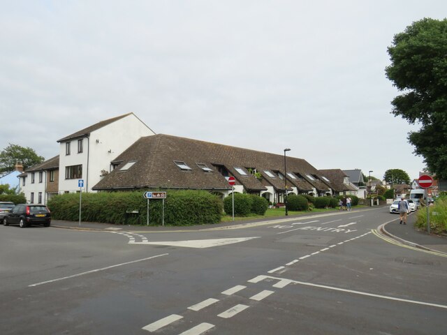
Whitehall, Christchurch
Whitehall is a residential road in Christchurch. It is on the route of National Cycle Network route 2.
National Cycle Network Route 2
National Route 2 will link Dover with St. Austell when complete via the south coast of England and is sometimes referred to as the South Coast Cycle Route.
The route is only fully open, at present, and signed between Dover and Brighton, but is still under development between Brighton and St. Austell.
The National Cycle Network
The National Cycle Network is a network of cycle routes. It was created by the charity Sustrans Link
(Sustainable Transport), aided by a National Lottery grant.
Many routes aim to minimise contact with motor traffic, though 70% of them are on roads. In some cases the NCN uses pedestrian routes, disused railways, minor roads, canal towpaths, or traffic-calmed routes in towns and cities.
 Map © Crown Copyright")
TIP: Click the map for more Large scale mapping
- Grid Square
- SZ1592, 509 images (more nearby 🔍)
- Photographer
- Malc McDonald (more nearby)
- Date Taken
- Friday, 20 August, 2021 (more nearby)
- Submitted
- Friday, 24 September, 2021
- Subject Location
-
OSGB36:
 SZ 1566 9247 [10m precision]
WGS84: 50:43.8983N 1:46.7685W - Camera Location
-
OSGB36: SZ 1565 9247
- View Direction
- EAST (about 90 degrees)