2021
SP3584 : Grange Road
taken 3 years ago, near to Hawkesbury, Warwickshire, England
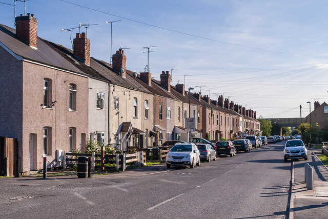
Grange Road
Turn of the 19th/20th Centuries terraced housing on Grange Road. The 1904 1:2,500 map, on which they are first shown, also shows the extension of the adjacent brickworks, with a tramway connecting the works with the Coventry Canal shown as running along the rear of the gardens behind the terrace, suggesting that the houses may have been built for brickmakers at the works. In the right background is the M6 motorway.
 Map © Crown Copyright")
TIP: Click the map for more Large scale mapping
- Grid Square
- SP3584, 121 images (more nearby 🔍)
- Photographer
- Ian Capper (more nearby)
- Date Taken
- Thursday, 23 September, 2021 (more nearby)
- Submitted
- Tuesday, 28 September, 2021
- Subject Location
-
OSGB36:
 SP 358 843 [100m precision]
WGS84: 52:27.3532N 1:28.4375W - Camera Location
-
OSGB36: SP 358 843
- View Direction
- South-southwest (about 202 degrees)