2021
NZ0631 : Hill road descending towards Meeting of the Grains
taken 3 years ago, near to Redford, County Durham, England
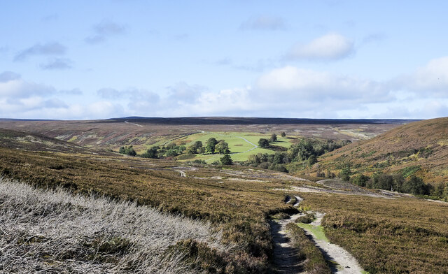
Hill road descending towards Meeting of the Grains
The road, also the route of a public footpath, is used by the owning estate to manage the surrounding grouse moors. The Meeting of the Grains is a location below the grassed enclosures; it's the confluence of two streams, North Grain Beck and South Grain Beck.
 Map © Crown Copyright")
TIP: Click the map for more Large scale mapping
- Grid Square
- NZ0631, 14 images (more nearby 🔍)
- Photographer
- Trevor Littlewood (more nearby)
- Date Taken
- Friday, 15 October, 2021 (more nearby)
- Submitted
- Friday, 29 October, 2021
- Subject Location
-
OSGB36:
 NZ 0603 3123 [10m precision]
WGS84: 54:40.5660N 1:54.4805W - Camera Location
-
OSGB36: NZ 0613 3116
- View Direction
- Northwest (about 315 degrees)