2021
TL1407 : Flush Bracket 1277, Verulam Road
taken 2 years ago, near to St Albans, Hertfordshire, England
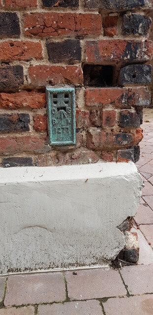
Flush Bracket 1277, Verulam Road
A flush bracket is a special type of bench mark installed by the Ordnance Survey. This one, number 1277, was originally fixed into the wall of the Spotted Bull in about 1914 as part of a levelling line from Hemel Hempstead to Buntingford. In the mid 2010s the pub was converted to dwellings.
 Map © Crown Copyright")
TIP: Click the map for more Large scale mapping
- Grid Square
- TL1407, 883 images (more nearby 🔍)
- Photographer
- Paul Collins (more nearby)
- Date Taken
- Wednesday, 27 October, 2021 (more nearby)
- Submitted
- Saturday, 30 October, 2021
- Subject Location
-
OSGB36:
 TL 1455 0736 [10m precision]
WGS84: 51:45.1937N 0:20.5146W - Camera Location
-
OSGB36: TL 14566 07372
- View Direction
- South-southwest (about 202 degrees)