2021
SE4048 : Path in Wetherby
taken 3 years ago, near to Wetherby, Leeds, England
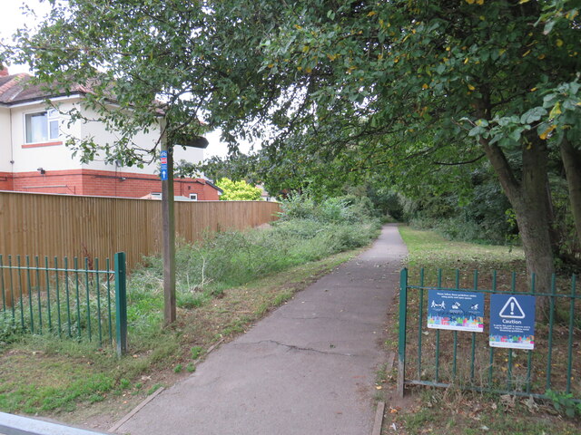
Path in Wetherby
This path in Wetherby is shared by pedestrians and cyclists. It forms part of route 665 of the National Cycle Network. The path follows the route of a dismantled railway. Here, the railway was in a cutting, but the cutting has been filled in to bring the path up to street level.
National Cycle Network route 665
Route 665 of the National Cycle Network is a short route, connecting the towns of Wetherby and Tadcaster to York.
For more informaiton, see the Sustrans website: Link
The National Cycle Network
The National Cycle Network is a network of cycle routes. It was created by the charity Sustrans Link
(Sustainable Transport), aided by a National Lottery grant.
Many routes aim to minimise contact with motor traffic, though 70% of them are on roads. In some cases the NCN uses pedestrian routes, disused railways, minor roads, canal towpaths, or traffic-calmed routes in towns and cities.
 Map © Crown Copyright")
TIP: Click the map for more Large scale mapping
- Grid Square
- SE4048, 661 images (more nearby 🔍)
- Photographer
- Malc McDonald (more nearby)
- Date Taken
- Thursday, 14 October, 2021 (more nearby)
- Submitted
- Tuesday, 2 November, 2021
- Subject Location
-
OSGB36:
 SE 4022 4877 [10m precision]
WGS84: 53:56.0098N 1:23.3337W - Camera Location
-
OSGB36: SE 4022 4877
- View Direction
- East-northeast (about 67 degrees)