NY5563 : Lanercost Priory
taken 3 years ago, near to Lanercost, Cumbria, England
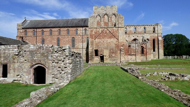
Lanercost Priory was founded sometime between 1165 and 1174 by Henry II. It was built using stones from Hadrian's Wall, nearby. When completed in 1220, canons came from the priory in Norfolk, and remained for some 370 years until the Dissolution of the Monasteries in 1536, by Henry VIII.
After the Dissolution, the building passed to Thomas Dacre, who converted some of the buildings into private dwellings (now called the Dacre Hall). The north aisle of the Priory church continued in use as a parish church; it was reroofed and sympathetically restored in the nineteenth century and is still in use today.
The rest of the building fell into disrepair and, in 1929, the Priory ruins were put into public ownership, and today they are managed by English Heritage. There are the remains of the North and South Transepts, the Choir, the Sanctuary and the Cellarium
The remainder of the Priory, second only to Furness Abbey in interest as a ruin, is now in the hands of English Heritage.
LinkLanercost Priory (English Heritage)
Link
Link
 Map © Crown Copyright")
- Grid Square
- NY5563, 269 images (more nearby 🔍)
- Photographer
- Sandy Gerrard (more nearby)
- Date Taken
- Wednesday, 8 September, 2021 (more nearby)
- Submitted
- Tuesday, 9 November, 2021
- Subject Location
-
OSGB36:
 NY 5560 6372 [10m precision]
WGS84: 54:57.9669N 2:41.7014W - Camera Location
-
OSGB36: NY 5561 6367
- View Direction
- NORTH (about 0 degrees)