2021
NY7467 : Hadrian's Wall at Winshield Crags
taken 3 years ago, 4 km N of Melkridge, Northumberland, England
This is 1 of 2 images, with title starting with Hadrian's Wall at Winshield in this square
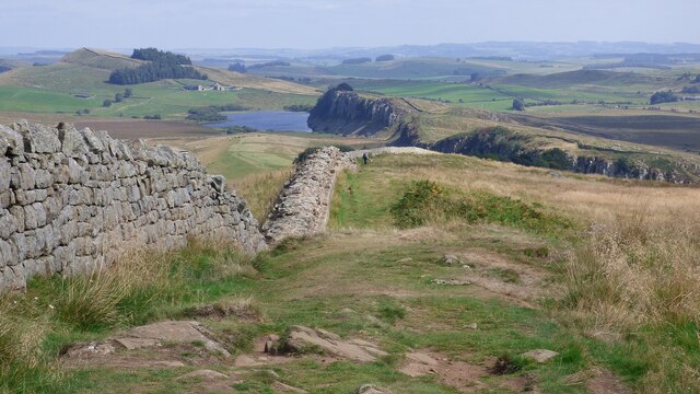
Hadrian's Wall at Winshield Crags
Hadrian's wall or 'Vallum Aelium' is the remains of a large Roman fortification. The wall extended west from Segedunum at Wallsend on the River Tyne to the shore of the Solway Firth, ending a short but unknown distance west of the village of Bowness-on-Solway. Construction probably started sometime in AD 122 and was largely completed within six years.
The remains were made a UNESCO World Heritage Site in 1987.
See other images of Hadrian's Wall
The remains were made a UNESCO World Heritage Site in 1987.
See other images of Hadrian's Wall
 Map © Crown Copyright")
TIP: Click the map for more Large scale mapping
- Grid Square
- NY7467, 99 images (more nearby 🔍)
- Photographer
- Sandy Gerrard (more nearby)
- Date Taken
- Thursday, 2 September, 2021 (more nearby)
- Submitted
- Sunday, 14 November, 2021
- Subject Location
-
OSGB36:
 NY 7432 6758 [10m precision]
WGS84: 55:0.1273N 2:24.1794W - Camera Location
-
OSGB36: NY 74220 67564
- View Direction
- EAST (about 90 degrees)