2021
NY8070 : Milecastle 35 on Hadrian's Wall at Sewingshields
taken 5 years ago, near to Halleypike Lough [Water feature], Northumberland, Great Britain
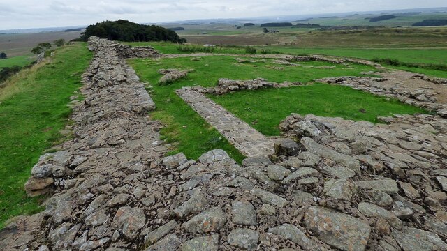
Milecastle 35 on Hadrian's Wall at Sewingshields
Hadrian's Wall (provided by Ashley Dace)
Hadrian's Wall or 'Vallum Aelium' is the remains of a large Roman fortification. The wall extended west from Segedunum at Wallsend on the River Tyne to the shore of the Solway Firth, ending a short but unknown distance west of the village of Bowness-on-Solway. Construction probably started some time in AD 122 and was largely completed within six years.
The remains were made a UNESCO World Heritage Site in 1987.
Geographical Context:
Historic sites and artefacts
Uplands
Paths
Boundary, Barrier
Defence, Military
Moorland
Primary Subject:
Roman Remains
other tags:
Hadrians Wall Milecastle
Click a tag, to view other nearby images.
This photo is linked from:
Automatic Clusters:
· Milecastle 35 [14]
·
- Grid Square
- NY8070, 68 images (more nearby 🔍)
- Photographer
- Sandy Gerrard (more nearby)
- Date Taken
- Monday, 13 September, 2021 (more nearby)
- Submitted
- Tuesday, 16 November, 2021
- Subject Location
-
OSGB36:
NY 8052 7017
[10m precision]
WGS84: 55:1.5407N 2:18.3747W - Camera Location
-
OSGB36:
NY 8048 7018
- View Direction
- EAST (about 90 degrees)
