2008
SE0623 : Rochdale Canal, Sowerby Bridge
taken 16 years ago, near to Sowerby Bridge, Calderdale, England
This is 1 of 9 images, with title Rochdale Canal, Sowerby Bridge in this square
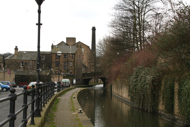
Rochdale Canal, Sowerby Bridge
Looking west from Tuel Lock. The chimney belongs to the Corporation Mill. The bridge carries Tower Hill, which used to be the lower end of Tuel Lane.
 Map © Crown Copyright")
TIP: Click the map for more Large scale mapping
- Grid Square
- SE0623, 421 images (more nearby 🔍)
- Photographer
- Dr Neil Clifton (more nearby)
- Date Taken
- Saturday, 23 February, 2008 (more nearby)
- Submitted
- Sunday, 24 February, 2008
- Subject Location
-
OSGB36:
 SE 060 236 [100m precision]
WGS84: 53:42.5436N 1:54.6075W - Camera Location
-
OSGB36: SE 061 236
- View Direction
- West-southwest (about 247 degrees)