2008
SO4876 : St Mary the Virgin, Bromfield
taken 16 years ago, near to Bromfield, Shropshire, England
This is 1 of 9 images, with title St Mary the Virgin, Bromfield in this square
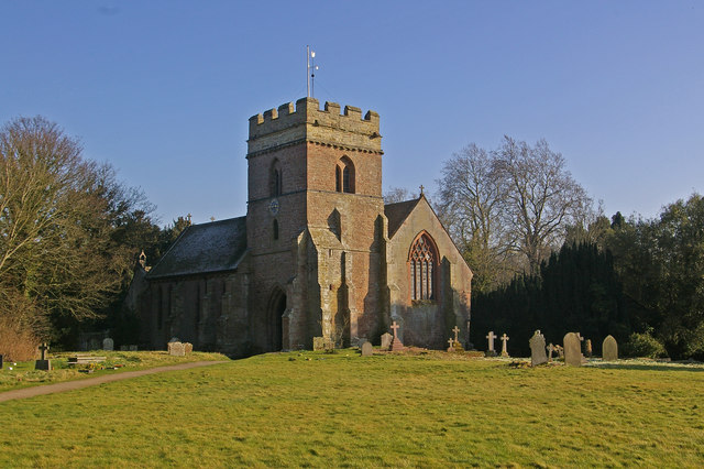
St Mary the Virgin, Bromfield
Originally a Benedictine Priory church, dating from 1155, with 13th and 16th century additions and restored in 1890.
 Map © Crown Copyright")
TIP: Click the map for more Large scale mapping
- Grid Square
- SO4876, 419 images (more nearby 🔍)
- Photographer
- Ian Capper (more nearby)
- Date Taken
- Monday, 18 February, 2008 (more nearby)
- Submitted
- Monday, 25 February, 2008
- Subject Location
-
OSGB36:
 SO 481 768 [100m precision]
WGS84: 52:23.2139N 2:45.7591W - Camera Location
-
OSGB36: SO 481 768
- View Direction
- East-southeast (about 112 degrees)