2021
SE0228 : View of Luddenden Dean towards Catherine House
taken 2 years ago, near to Wainstalls, Calderdale, England
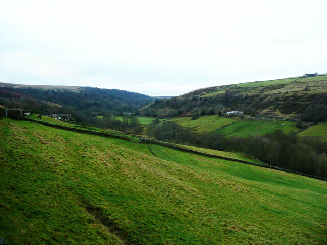
View of Luddenden Dean towards Catherine House
This is a revisit to the first geograph for the square, taken in June 2004. Unfortunately after a bright start to the day the afternoon turned out to be very gloomy. Catherine House is just to the right of the two animals on the left. The houses on the other side of the valley are captioned 'The Nunnery' on the large-scale map, and are on Low Lane. The building on the skyline must, I think, be on Castle Carr Road. No doubt all the trees will have grown a bit, but otherwisw there has been no change.
 Map © Crown Copyright")
TIP: Click the map for more Large scale mapping
- Grid Square
- SE0228, 87 images (more nearby 🔍)
- Photographer
- Humphrey Bolton (more nearby)
- Date Taken
- Thursday, 16 December, 2021 (more nearby)
- Submitted
- Thursday, 16 December, 2021
- Subject Location
-
OSGB36:
 SE 0265 2865 [10m precision]
WGS84: 53:45.2525N 1:57.6774W - Camera Location
-
OSGB36: SE 0265 2857
- View Direction
- NORTH (about 0 degrees)