2022
TM5191 : Fundamental Bench Mark: Whitton Green South
taken 2 years ago, near to Oulton Broad, Suffolk, England
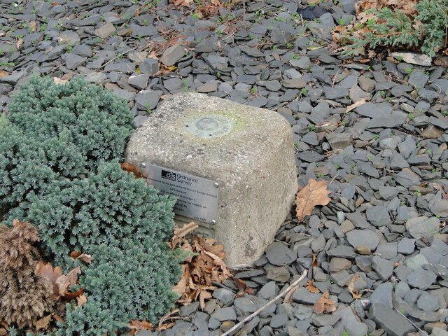
Fundamental Bench Mark: Whitton Green South
On the top is the rivet marking the 'height above datum' although it is not given. A plaque reads " This monument forms part of the Ordnance Survey National GPS Network. It is an offence to damage it."
 Map © Crown Copyright")
TIP: Click the map for more Large scale mapping
- Grid Square
- TM5191, 68 images (more nearby 🔍)
- Photographer
- Adrian S Pye (more nearby)
- Date Taken
- Sunday, 2 January, 2022 (more nearby)
- Submitted
- Sunday, 2 January, 2022
- Subject Location
-
OSGB36:
 TM 51872 91245 [1m precision]
WGS84: 52:27.6607N 1:42.3737E - Camera Location
-
OSGB36: TM 5187 9124
- View Direction
- NORTH (about 0 degrees)