2022
SO3698 : Manstone Rock on the Stiperstones
taken 2 years ago, near to Pennerley, Shropshire, England
This is 1 of 7 images, with title Manstone Rock on the Stiperstones in this square
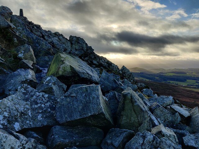
Manstone Rock on the Stiperstones
Manstone Rock is the highest point of the Stiperstones.
The Stiperstones is a hill in Shropshire. The quartzite rock of the ridge formed about 480 million years ago. During the last Ice Age, the Stiperstones lay on the eastern edge of the Welsh ice sheet. At 536 metres (1,759 ft) above sea level it is the second-highest hill in Shropshire. The Stiperstones are known for a series of tors of quartzite, there are six main tors, Shepherd's Rock, Devil's Chair, Manstone Rock, Cranberry Rock, Nipstone Rock and the Rock.
The Stiperstones is a hill in Shropshire. The quartzite rock of the ridge formed about 480 million years ago. During the last Ice Age, the Stiperstones lay on the eastern edge of the Welsh ice sheet. At 536 metres (1,759 ft) above sea level it is the second-highest hill in Shropshire. The Stiperstones are known for a series of tors of quartzite, there are six main tors, Shepherd's Rock, Devil's Chair, Manstone Rock, Cranberry Rock, Nipstone Rock and the Rock.
 Map © Crown Copyright")
TIP: Click the map for more Large scale mapping
- Grid Square
- SO3698, 165 images (more nearby 🔍)
- Photographer
- Mat Fascione (more nearby)
- Date Taken
- Sunday, 2 January, 2022 (more nearby)
- Submitted
- Thursday, 6 January, 2022
- Subject Location
-
OSGB36:
 SO 3674 9865 [10m precision]
WGS84: 52:34.9178N 2:56.1030W - Camera Location
-
OSGB36: SO 3674 9865
- View Direction
- SOUTH (about 180 degrees)